
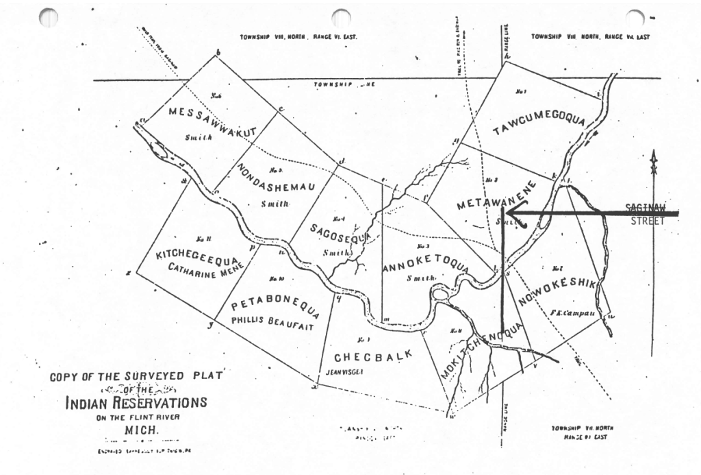
Flint’s history is that it was a collection of 11 Indian Reservations along the Saginaw Trail next to the Flint River called Grand Traverse Village. Present day Saginaw Street is the bold line noted by the arrow on the map.
Indigenous burial mounds were documented along the Flint River in the 1830s and archaeological digs in 1899 noted the presence of historic indigenous villages. The names of these villages became enshrined in the Saginaw Treaty of 1819 that established 11 reservations along the Flint River under Governor Lewis Cass. The reservations constituted 7,041 acres of land along the south bend of the river.

Leave a comment