Environment Health History Land Planning Transit

Mapping Flint
Flint, the Vehicle City, birthplace of the General Motors Company and the United Auto Workers, a vanishing city propelled to the spotlight by one of the largest municipal public health crises in the 21st Century, the Flint Water Crisis
Category: Health
-
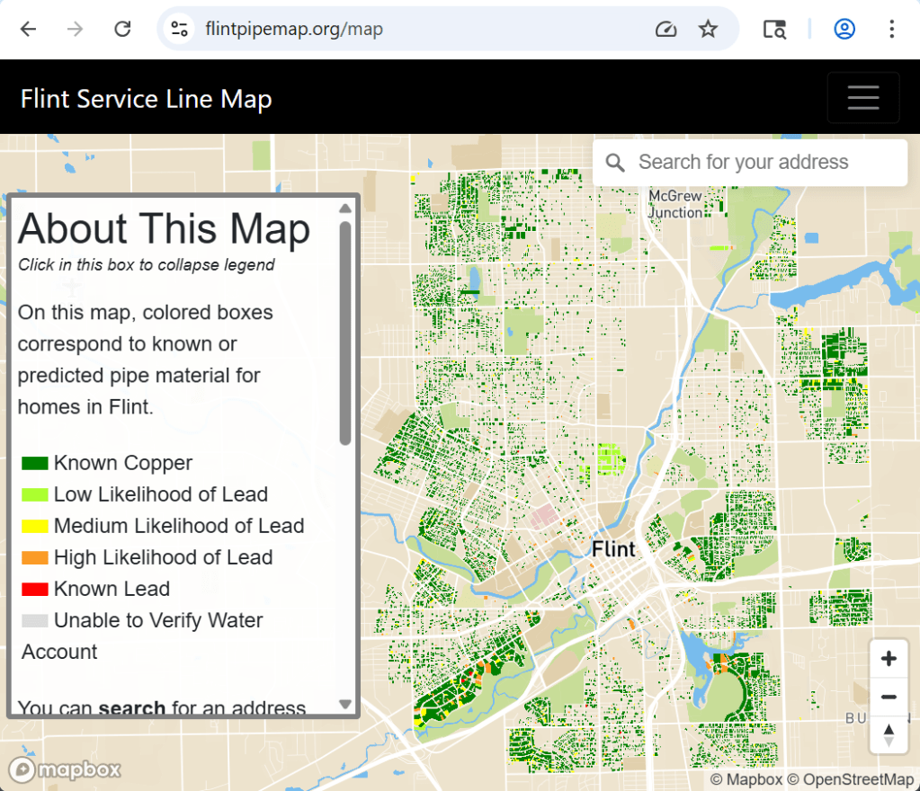
The “Flint Pipe Map” was created in October 2020 and last updated in June 2022. The map is based off of a mathematical model that predicts water service line material based on multiple factors like building age, existing water line inspection data, and other factors. More from the FAQ: This map provides information about the…
-

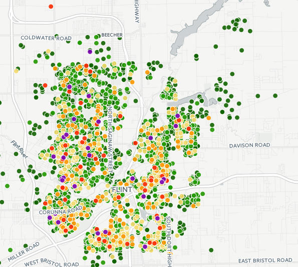
This map from National Geographic was published with the article: “Five years on, the Flint Water Crisis is nowhere near over.” Much of the water testing in Flint showed elevated lead levels remained high into 2015. The downtown band with Wards 5, 6, and 7 showed the highest levels.
-
This site began idea began from my engagement with MSU researchers after the Flint Water Crisis where we focused on mapping food resources that help mitigate lead in the body (high calcium and high vitamin C foods). More recently I started noticing that many Flint mapping efforts from the Flint Water Crisis time period were…
