
This map is one of 35 other cities profiled in a city market survey by the advertising department of the Curtis Publishing Company, called: “City Markets: A Study of Thirty-Five Cities.” The primary market assessment conducted here was based on circulation of newspapers and magazines, but included auto sales, consumer goods, and transportation spending.
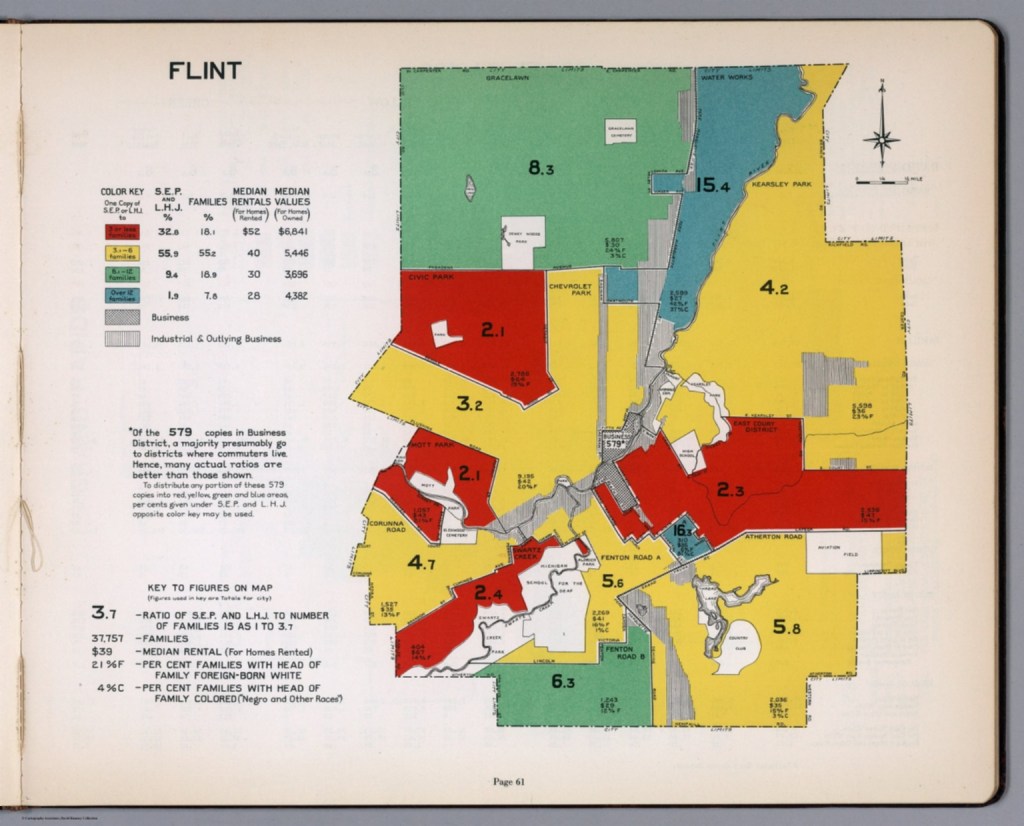
The report notes that the 1932 maps are improved from earlier versions as “homogeneous residential areas” have their own boundaries rather than conventional or municipal boundaries. The map also has similarities with the well-known “redlining” maps, but in this case it is “blue-lining”:
“[…] manager was instructed to conduct circulation work in the better residential areas (colored red and yellow on the Survey map). He was forbidden to do work in areas colored blue (for the most part with foreign-speaking or colored residents).
In 1932, Flint’s Southside neighborhood of Floral Park existed in the “blue-lined” area near the center of the city before eventually becoming home to the intersection cloverleaf of I-475 and I-69. The cloverleaf project came to be known as the “Floral Park Interchange.”

Leave a comment