Environment Health History Land Planning Transit

Mapping Flint
Flint, the Vehicle City, birthplace of the General Motors Company and the United Auto Workers, a vanishing city propelled to the spotlight by one of the largest municipal public health crises in the 21st Century, the Flint Water Crisis
Category: Environment
-
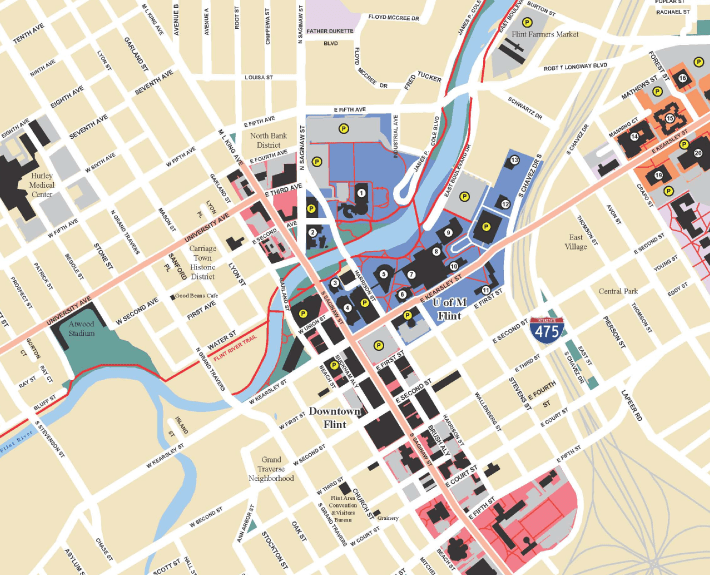
I found these “Flint by Foot” maps by The Greenway Collaborative to be interesting as a point in time image of what Downtown looked like and how opportunities were presented before the Great Recession and before the Flint Water Crisis. Walking across Downtown from Kettering to Mott Park past UM Flint campus was estimated to…
-
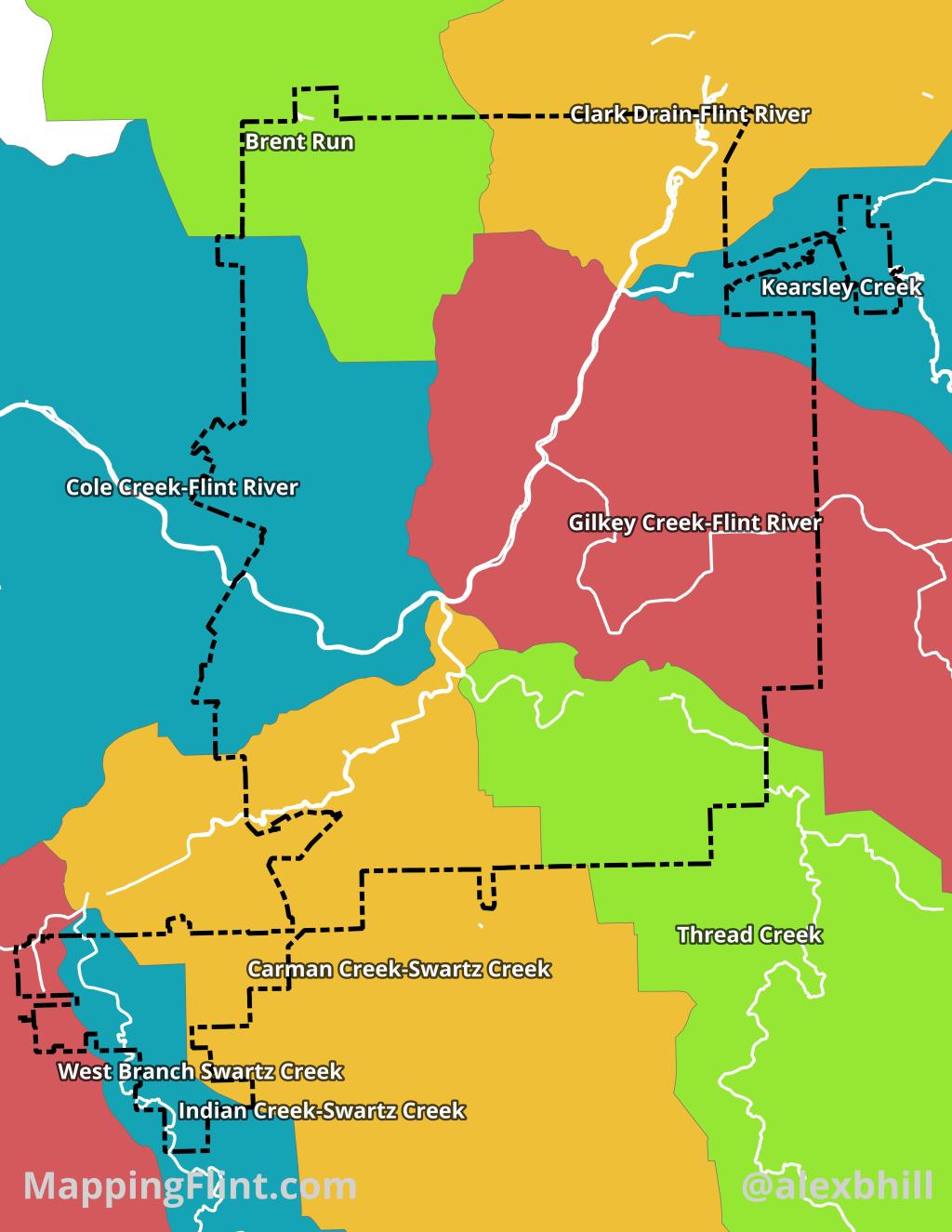
The Flint River Watershed is a vital, 1,363-square-mile drainage basin across seven southeastern Michigan counties, ultimately feeding into the Saginaw Bay and Lake Huron. Originating in Columbiaville, the river flows northwest through diverse landscapes, including agriculture, forests, and the urban center of Flint. Historically central to regional development and mill power, the watershed now faces…
-
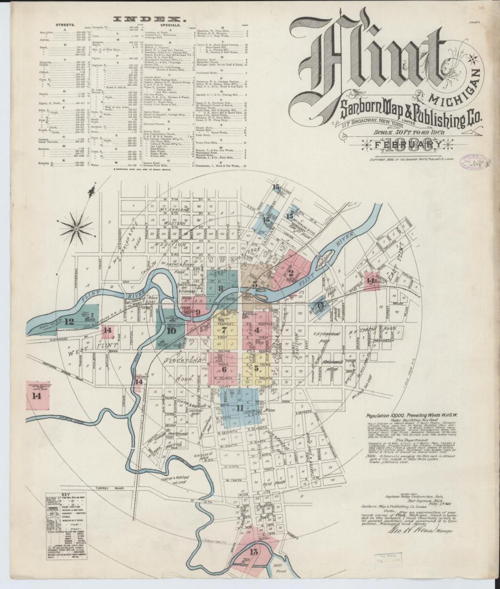
Sanborn maps are a useful historical tool and often reveal interesting pieces of the past that are long forgotten. On this fire insurance map in particular I was surprised to see such a sizable island in the Flint River, Crapo Island. Named for Henry Crapo, the UM Flint Genesee Historical Collections Center notes the Crapo…
