Environment Health History Land Planning Transit

Mapping Flint
Flint, the Vehicle City, birthplace of the General Motors Company and the United Auto Workers, a vanishing city propelled to the spotlight by one of the largest municipal public health crises in the 21st Century, the Flint Water Crisis
Category: Land
-
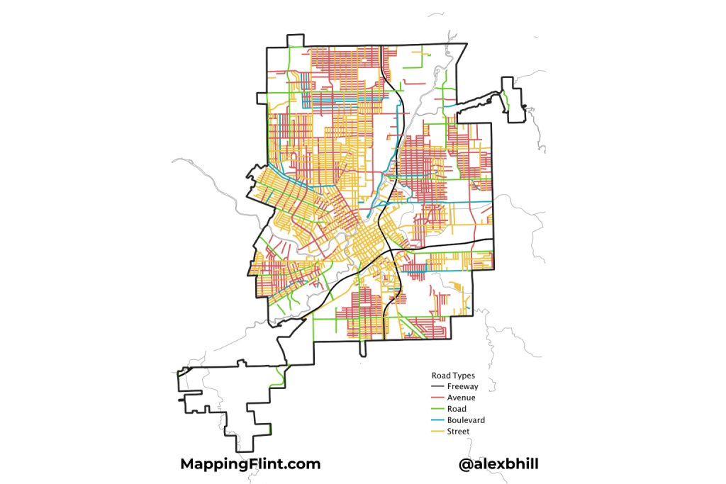
Flint’s roadways follow a merged historical pattern and urban grid layout. The downtown area features a high-density, traditional grid network near the Flint River and surrounding areas like Saginaw Street and Beach Street. Much like Detroit, early roadways were defined around the river direction before being planned by cardinal directions. Key north-south routes include Saginaw…
-
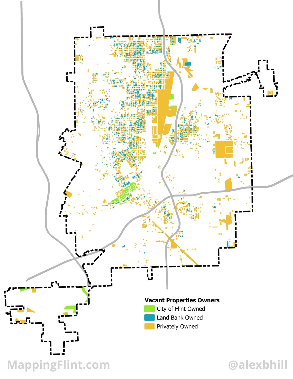
Flint is home to “The” Land Bank, or at least the first modern implementation of a public authority tasked with managing vacant properties. Today there are 353 land banks at the city, county, or state level. Most land banks take advantage of state level laws that enable them to exist and in Michigan that law…
-
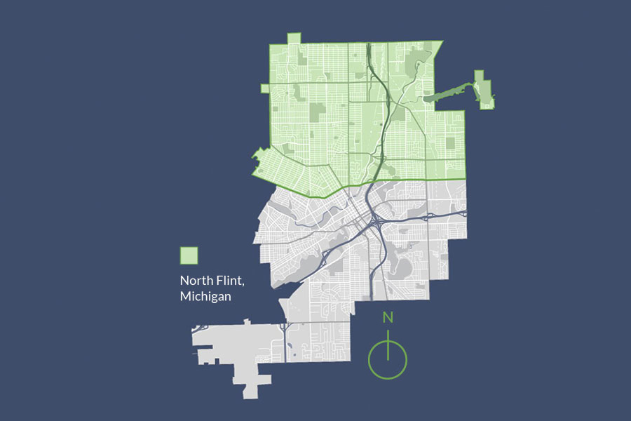
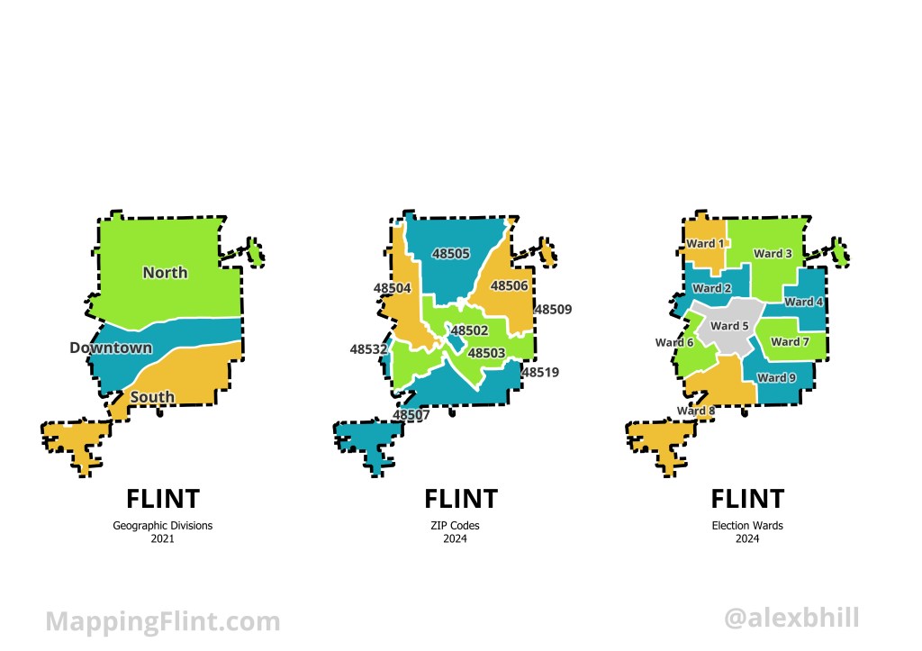
What cardinal direction matters most in Flint? The Mott Foundation is focused on North Flint: “We define north Flint as everything within the city limits north of the Flushing Road/5th Avenue/Longway Boulevard corridor.”
-
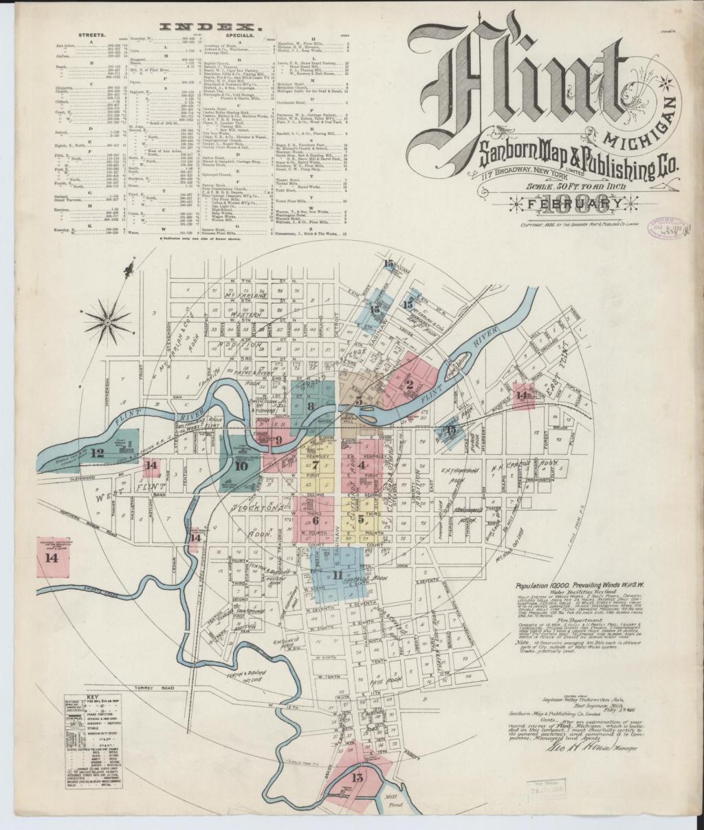
Sanborn maps are a useful historical tool and often reveal interesting pieces of the past that are long forgotten. On this fire insurance map in particular I was surprised to see such a sizable island in the Flint River, Crapo Island. Named for Henry Crapo, the UM Flint Genesee Historical Collections Center notes the Crapo…
-
Flint, to me, has always been about family and cars. My great grandfather worked for Chevrolet in what became better known as “Chevy in the hole.” My grandfather worked at the Flint Assembly Plant and was an active member of the UAW. My grandmother’s family opened the first Chrysler dealership in the Flint area in…
-
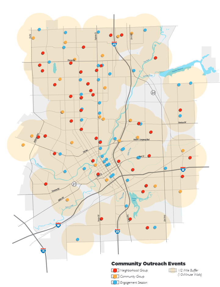
Flint embarked on an ambitious master planning process when it didn’t even have a planning department in 2013. This was the city’s first master plan since 1960. The “Imagine Flint” effort engaged over 500 residents through 280 engagement sessions and hosted community events. Flint is currently in another master plan update process for 2024-2025. The…
