Environment Health History Land Planning Research Transit

Mapping Flint
Flint, the Vehicle City, birthplace of the General Motors Company and the United Auto Workers, a vanishing city propelled to the spotlight by one of the largest municipal public health crises in the 21st Century, the Flint Water Crisis
Category: History
-
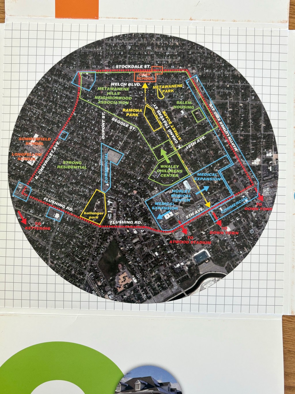
The Flint Chapter of the American Institute of Architects worked on this community planning effort for the AIA 150 Flint Partnership in 2007 with the Metawanene Hills Neighborhood Association. The project is titled: “Rediscovering Community in a Flint Neighborhood” and lays out four broad areas of opportunity for the neighborhood adjacent to the Whaley Children’s…
-
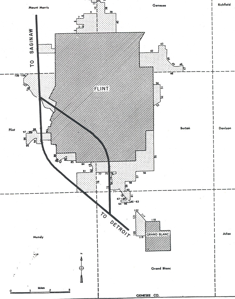
This map popped up in the Wikimedia Commons. The map comes from the Bureau of Public Roads (September 1955). The book is an abstract art piece of how we carved our cities up so that cars could go fast. The book includes a few introductory paragraphs that note the maps show approved routes and additions…
-
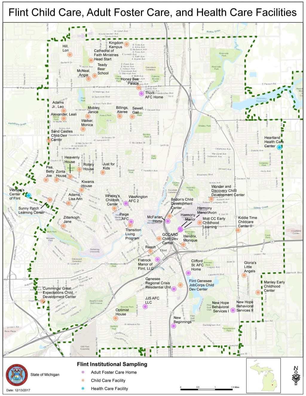
Throughout the Flint Water Crisis, the State of Michigan took regular water samples from childcare centers, adult foster care, and health care facilities. Water samples showed that lead levels were still elevated at three large daycare centers in December 2017. Follow-up testing in 2018 showed just one water sample at one location with 93 ppb…
-
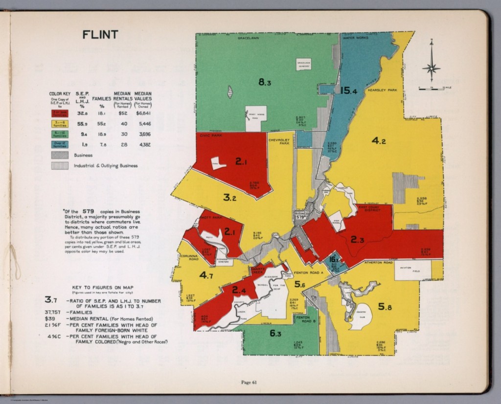
This map is one of 35 other cities profiled in a city market survey by the advertising department of the Curtis Publishing Company, called: “City Markets: A Study of Thirty-Five Cities.” The primary market assessment conducted here was based on circulation of newspapers and magazines, but included auto sales, consumer goods, and transportation spending. The…
-
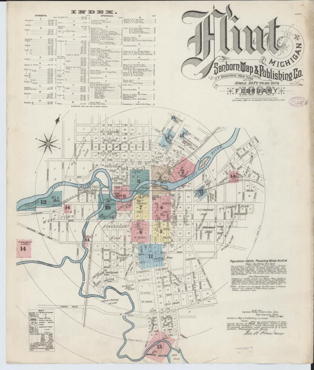
Sanborn maps are a useful historical tool and often reveal interesting pieces of the past that are long forgotten. On this fire insurance map in particular I was surprised to see such a sizable island in the Flint River, Crapo Island. Named for Henry Crapo, the UM Flint Genesee Historical Collections Center notes the Crapo…
-
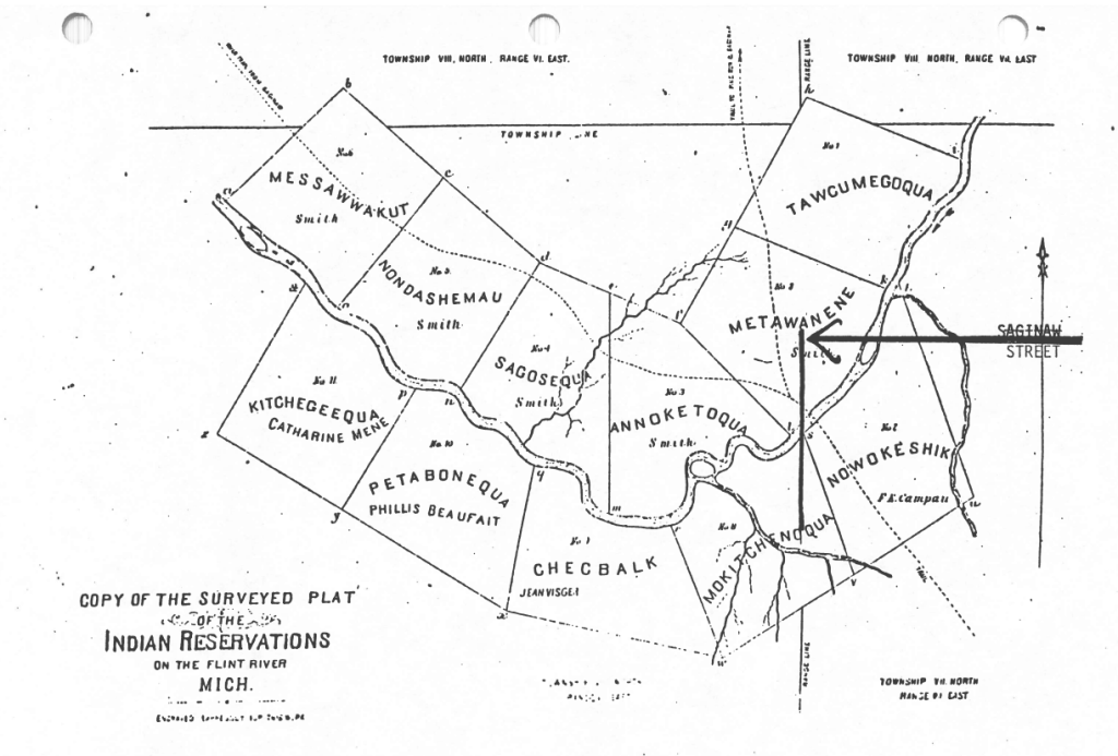
Flint’s history is that it was a collection of 11 Indian Reservations along the Saginaw Trail next to the Flint River called Grand Traverse Village. Present day Saginaw Street is the bold line noted by the arrow on the map. Indigenous burial mounds were documented along the Flint River in the 1830s and archaeological digs…
-

This map from National Geographic was published with the article: “Five years on, the Flint Water Crisis is nowhere near over.” Much of the water testing in Flint showed elevated lead levels remained high into 2015. The downtown band with Wards 5, 6, and 7 showed the highest levels.
-

This historical gem from the Library of Congress comes from the “Atlas of Genesee County, Michigan” shows the City of Flint as a much smaller entity than present day with remnants of the Smith’s Indian Reservation that eventually became part of Flint proper. I was surprised to see that Michigan School for the Deaf has…

