
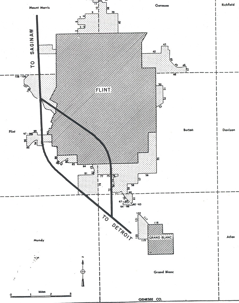
This map popped up in the Wikimedia Commons. The map comes from the Bureau of Public Roads (September 1955). The book is an abstract art piece of how we carved our cities up so that cars could go fast. The book includes a few introductory paragraphs that note the maps show approved routes and additions in urban areas served by the interstate highway system.
“Flint” (Map). General Location of National System of Interstate Highways Including All Additional Routes at Urban Areas Designated in September 1955 Scale not given. Washington, DC: Government Printing Office. p. 42. OCLC 4165975.
What is most interesting to me about this map is the city boundary still in flux. Flint is more of a rectangle than early iterations, but still doesn’t have the Bishop Airport appendage although the land was donated to the city for “aeronautical uses” in 1928. The Bishop Airport Airport Authority was established in 1987. There are other pieces of land yet to be annexed like the Kearsley Reservoir, but the airport stands out.


Leave a Reply