
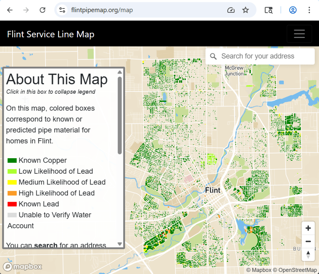
The “Flint Pipe Map” was created in October 2020 and last updated in June 2022. The map is based off of a mathematical model that predicts water service line material based on multiple factors like building age, existing water line inspection data, and other factors.
More from the FAQ:
This map provides information about the known or likely material of the water service lines at different addresses in Flint, Michigan. It is intended to share up-to-date water service line information with the citizens of Flint. The map includes information gathered by the City of Flint during water line inspections and/or replacements. At residential addresses where the City has not yet inspected the water service lines, the map indicates the likelihood of lead or galvanized steel service lines based on mathematical modeling by Dr. Jacob Abernethy and Dr. Eric Schwartz. The map website was built and is maintained by Jared Webb. Dr. Stacy Woods of the Natural Resources Defense Council collaborated on the map and site design.
Dr. Jacob Abernethy and Dr. Eric Schwartz and their affiliates do not guarantee the accuracy of the information contained in the Flint Water Service Line Materials Map or otherwise represent that the map is accurate. The Flint Water Service Line Materials Map shall be used for the sole purpose of providing Flint residents with the best available data regarding their water service lines, and not for any commercial, legal, or other use. Dr. Jacob Abernethy and Dr. Eric Schwartz reserve the right to alter, amend, or terminate at any time the display of the Flint Water Service Line Materials Map.

Leave a comment