
Flint, to me, has always been about family and cars.
My great grandfather worked for Chevrolet in what became better known as “Chevy in the hole.” My grandfather worked at the Flint Assembly Plant and was an active member of the UAW. My grandmother’s family opened the first Chrysler dealership in the Flint area in 1926 before running the Oldsmobile dealership.
Both of my parents grew up in Flint with stories of attending community schools, watching the spark plug parades, and ice skating at Atwood Stadium. Actually five members of my immediate family were born at St. Joe’s hospital which closed in 1997. My dad bought his first home on the Bradley Avenue hills of Crim notoriety.
My childhood was spent visiting the Cultural Center of the city, taking trips to the Flint Institute of Arts, Longway Planetarium, or the Flint Public Library, learning to swim at Hurley Health and Fitness, running the Crim, and taking classes at Mott Community College. I attended Powers Catholic when it was located in the North End and often volunteered with the St. Luke Center. Most of my family lived in areas of South End near Miller Road, Thread Lake, and Bristol Road.
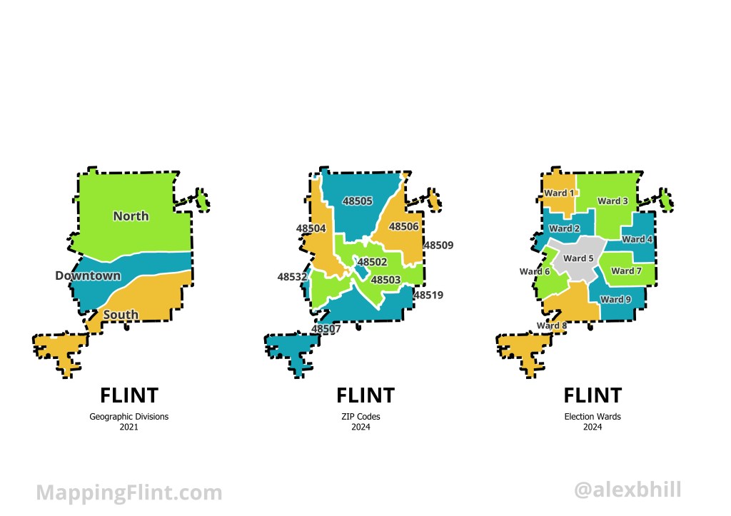
Thinking about all the Flint places important to my own story I tried to come up with a way to quickly reference the geography of the city. North, Downtown, and South area helpful geographic divisions. Specific ZIP codes are easy to know from family and business addresses. How do you represent Flint? What are the ways that you reference where you are in the city?
Produced for Flintside

Leave a comment