Flint, the Vehicle City, birthplace of the General Motors Company and the United Auto Workers, a vanishing city propelled to the spotlight by one of the largest municipal public health crises in the 21st Century, the Flint Water Crisis
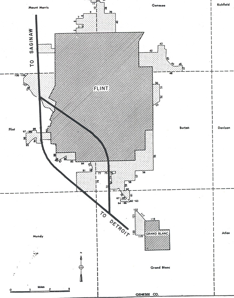
This map popped up in the Wikimedia Commons. The map comes from the Bureau of Public Roads (September 1955). The book is an abstract art piece of how we carved our cities up so that cars could go fast. The book includes a few introductory paragraphs that note the maps show approved routes and additions in urban areas served by the interstate highway system.
What is most interesting to me about this map is the city boundary still in flux. Flint is more of a rectangle than early iterations, but still doesn’t have the Bishop Airport appendage although the land was donated to the city for “aeronautical uses” in 1928. The Bishop Airport Airport Authority was established in 1987. There are other pieces of land yet to be annexed like the Kearsley Reservoir, but the airport stands out.
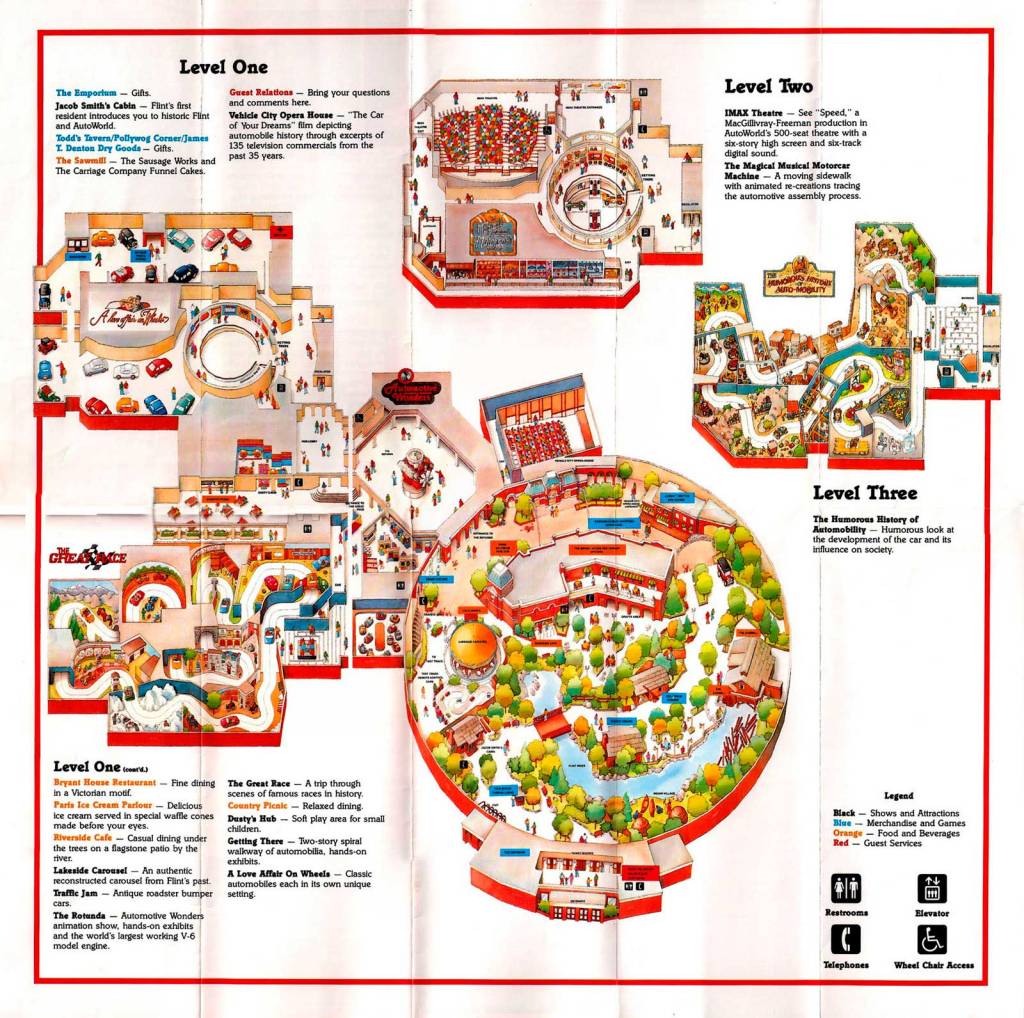
I still have an AutoWorld souvenir bag from my childhood, but by the time I was never old enough the Six Flags property was already closed (1985). The site (demolished in 1994) is now part of the UM Flint campus and the William White Building sits on part of the site today. Could the site have survived as a local museum on UM’s campus? Could it have maintained as a different kind of incubator for small businesses, urban agriculture, early childcare? AutoWorld is such a fascinating story from a marketing, political, and architectural standing.
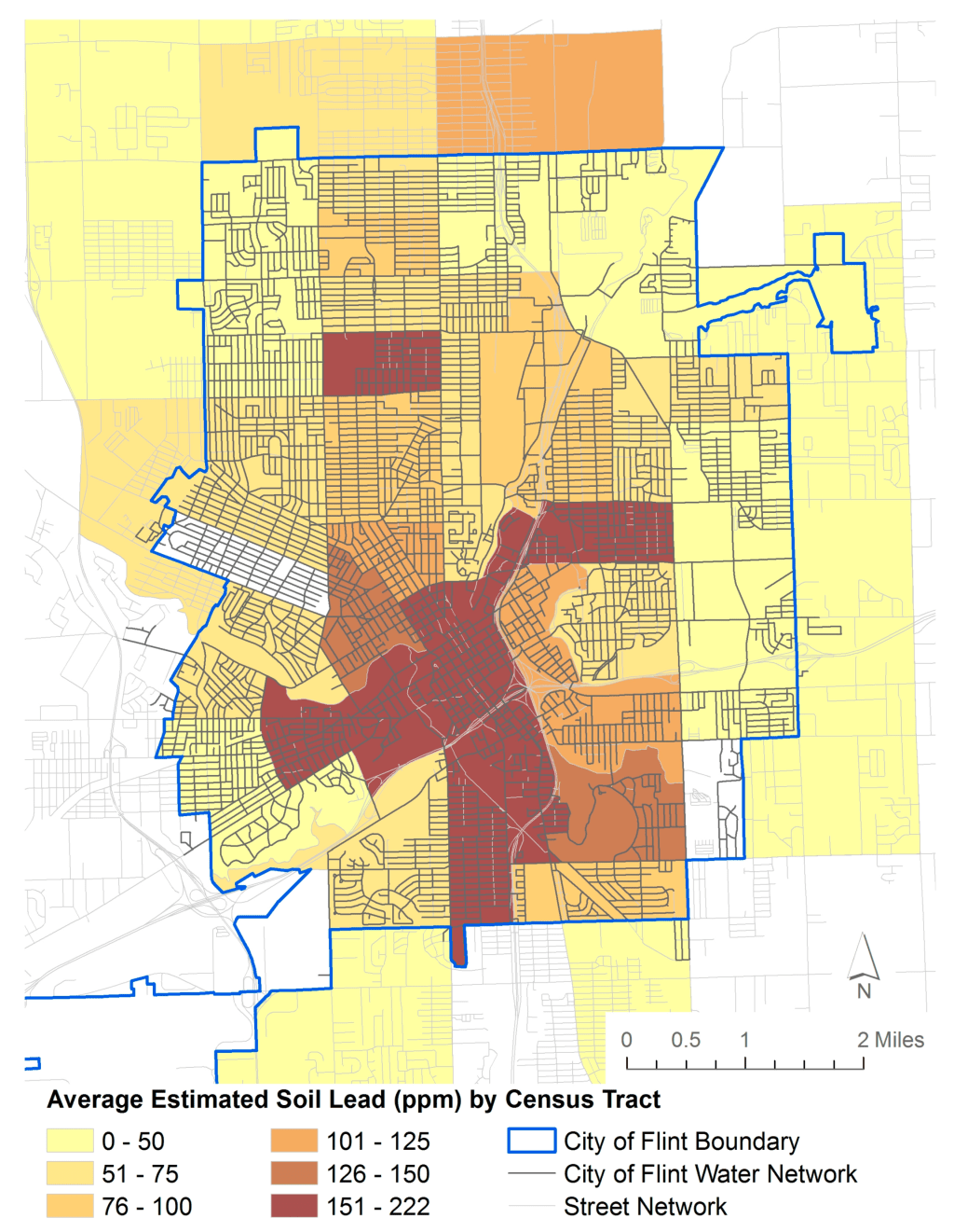
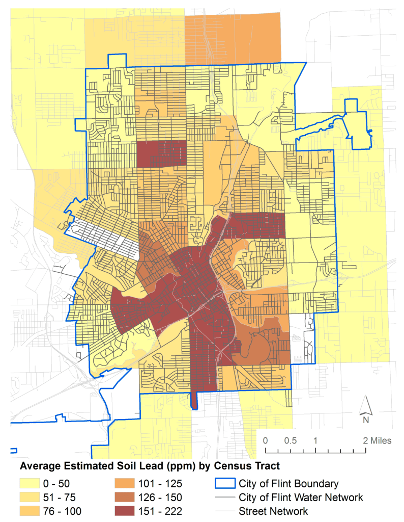
This map comes from an academic article published in the International Journal of Environmental Research and Public Health (IJERPH) by local Dr. Sadler from MSU and researchers from RMIT in Australia, IUPUI in Indiana, and Tulane University in Louisiana. A common concern with child lead exposure is the existence of lead dust that enters the air from the dirt (lead re-suspension), which is most common during summer high temperatures.
This paper integrates bulk composite soil samples previously collected by the Edible Flint local food collaborative throughout the city from 2011 to 2015. Each sample was collected at the start of the spring growing season (typically in the second quarter) from 10 to 15 randomly selected sites at personal residences and community gardens, exclusively in residential neighborhoods. Edible Flint staff and volunteers conducting the sampling were trained to use the Michigan State University soil test protocol, which included: sampling from untilled soils at a depth of 3–4 inches for lawns and 7 inches for gardens, using a metal or plastic hand spade to collect samples, and storing samples in Ziploc or plastic bags. A total of 248 samples were collected.
In 2016, I attended the Congress for New Urbanism event in Detroit, where data and tech startups were excitedly asking about the potential to buy up Flint real estate post-water crisis. I was surprised and appalled. I had already had family members move out of the city as quickly as they could, and there was still no clear solution or accountability. A 2023 study estimated that Flint properties lost $520 million in value as a result of the water crisis.
The Wall Street Journal recently published a story titled: “Investors piling into Flint’s dilapidated housing market,” specifically mentioning investors from New York, California, and Florida. The Wall Street Journal reported a 28% increase in Flint home prices, while the average home price is still around $200,000. Wards 3 and 6 have the most out-of-state taxpayers. Ward 3 has the most from Florida, and Ward 6 has the most from California.
This analysis does not dig into the ownership of LLC’s that are registered with a Flint address. A good example is the Flint Commerce Center LLC, which owns the former Buick City site and is run by Ashley Capital, the largest privately-held industrial real estate investment company in the US. Their main office is in New York City, with a Michigan office in Canton, Michigan. Overall, there are 4,547 LLCs listed as the primary property owner across Flint. Just 31% of those LLCs have a taxpayer address in Flint, and 27% have an out-of-state taxpayer address. The most common out-of-state taxpayer addresses come from Florida (701), California (637), Nevada (264), Texas (213), Georgia (187), and New York (153).
Not everyone utilizes an LLC to do their property purchasing and tax management. The overwhelming majority of parcels have taxpayer addresses in Michigan (95%), Grand Blanc is the top city (2%) after Flint proper (91%). McLaren Health, for example, has its properties registered to a Grand Blanc taxpayer address. Many corporations have their headquarters in other states. For example, GM has a Texas taxpayer address for the Flint Truck Assembly on Van Slyke. CSX rail company owns a good chunk of land and is based out of Florida. DPH Environmental Response Trust is the holding company formed after the Delphi Corporation went bankrupt and is based in Chicago, Illinois.
Many people have heard my ZIP Code soapbox speech and I recently wrote a longer piece about ZIP Codes in Detroit. In Flint, the oddity of ZIP Codes and the reliance on ZIP Codes for health statistics and health information tracking for the misunderstood “protection” of patient data. The short soapbox speech is that ZIP Codes are squiggly lines created for mail delivery that the Census turns into shapes because everyone knows their ZIP Code.
In Flint, ZIP Codes led to the failure to properly track disparate health impacts of lead poisoning during the Flint Water Crisis. This map and a great write-up come from Dick (Rick) Sadler, a medical geographer who worked on the blood lead analysis with Dr. Mona Hanna:
“One-third of all homes with a Flint ZIP code lie outside the city. Thus, the state’s numbers for Flint were watered down by an additional 50 percent of addresses that weren’t in the city and weren’t using Flint water. This is referred to in geography as the modifiable areal unit problem.”
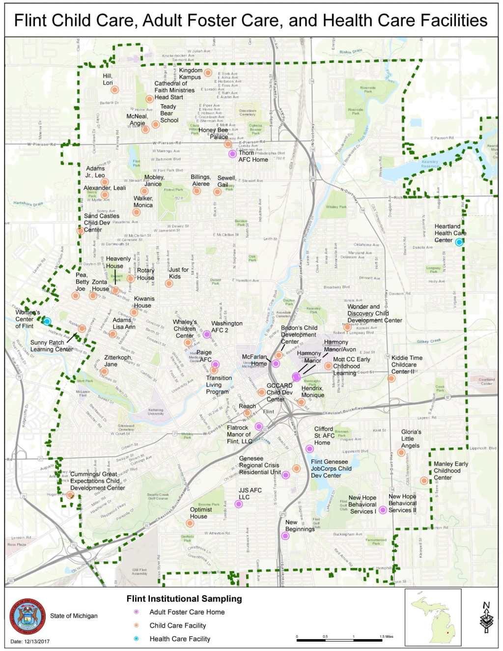
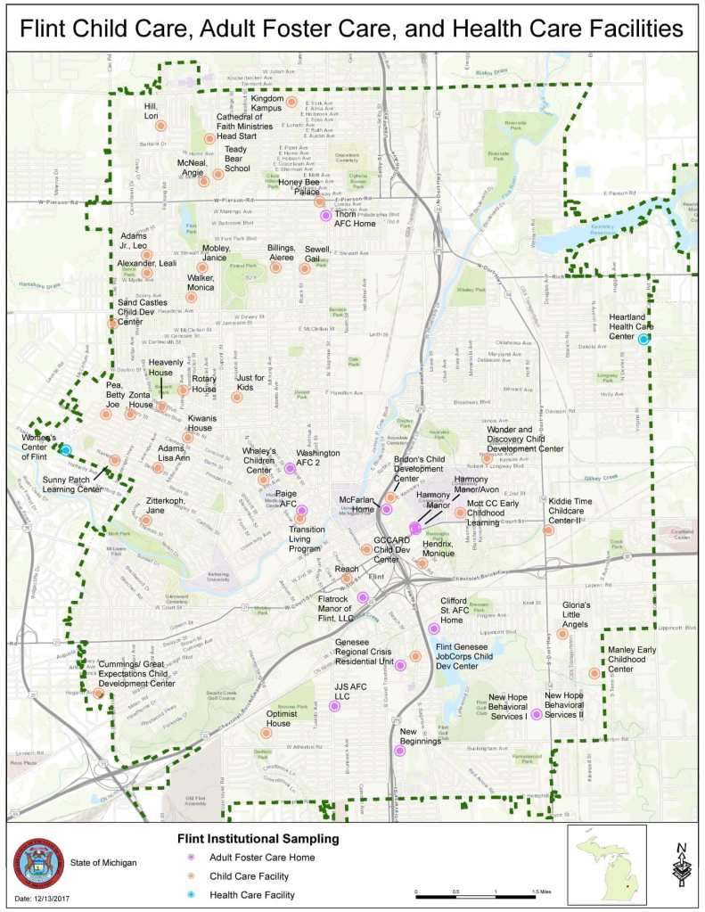
Throughout the Flint Water Crisis, the State of Michigan took regular water samples from childcare centers, adult foster care, and health care facilities. Water samples showed that lead levels were still elevated at three large daycare centers in December 2017. Follow-up testing in 2018 showed just one water sample at one location with 93 ppb elevated lead levels.
“During the months of November and December 2017, the Department of Licensing and Regulatory Affairs (DLARA) flushed the plumbing lines at each of the large Flint daycare facilities to and the Department of Environmental Quality (DEQ) sampled each facility. Follow-up samples were taken at points where lead levels exceeded 15 parts per billion (ppb) and/or copper levels exceeded 1,300 ppb.”
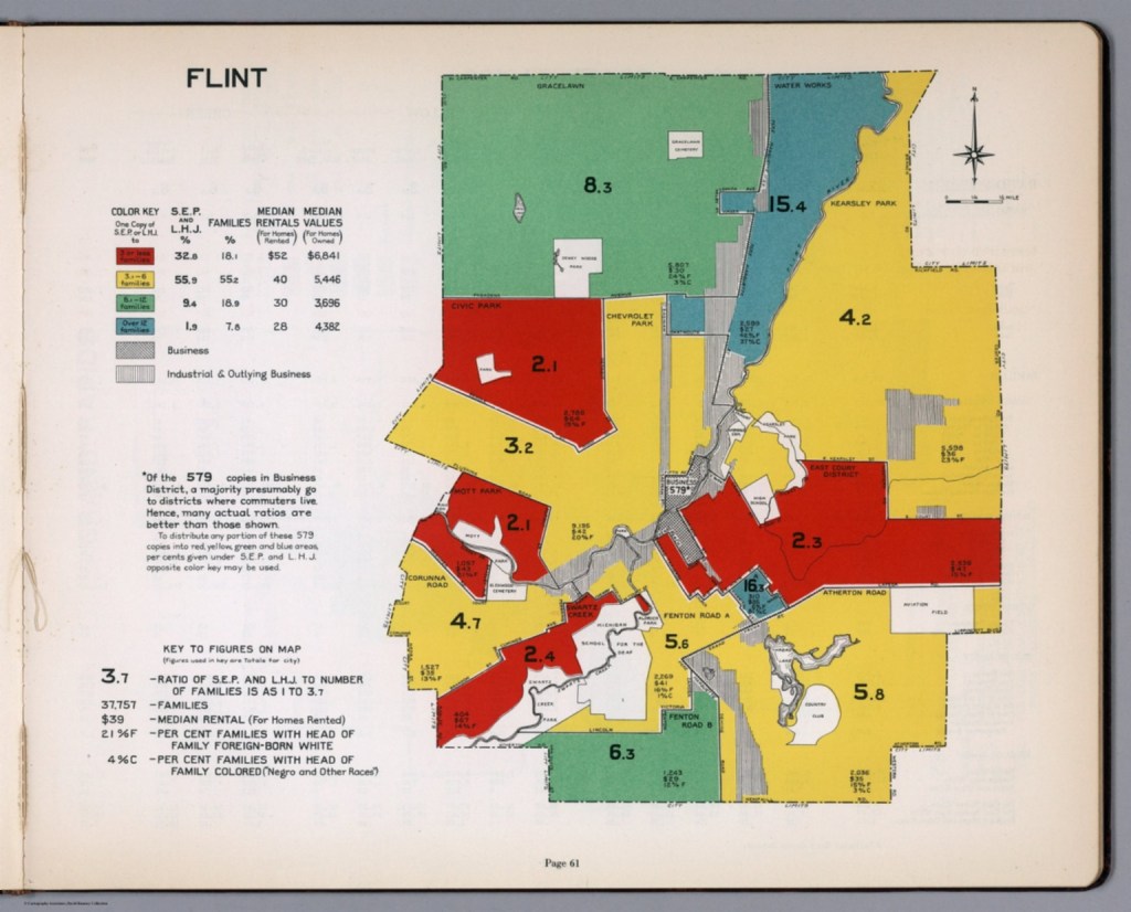
This map is one of 35 other cities profiled in a city market survey by the advertising department of the Curtis Publishing Company, called: “City Markets: A Study of Thirty-Five Cities.” The primary market assessment conducted here was based on circulation of newspapers and magazines, but included auto sales, consumer goods, and transportation spending.
The report notes that the 1932 maps are improved from earlier versions as “homogeneous residential areas” have their own boundaries rather than conventional or municipal boundaries. The map also has similarities with the well-known “redlining” maps, but in this case it is “blue-lining”:
“[…] manager was instructed to conduct circulation work in the better residential areas (colored red and yellow on the Survey map). He was forbidden to do work in areas colored blue (for the most part with foreign-speaking or colored residents).
In 1932, Flint’s Southside neighborhood of Floral Park existed in the “blue-lined” area near the center of the city before eventually becoming home to the intersection cloverleaf of I-475 and I-69. The cloverleaf project came to be known as the “Floral Park Interchange.”
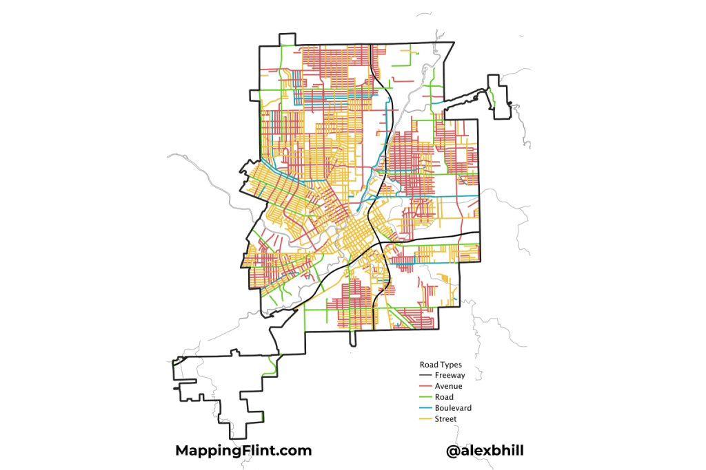
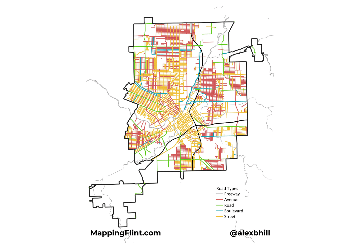
Flint’s roadways follow a merged historical pattern and urban grid layout. The downtown area features a high-density, traditional grid network near the Flint River and surrounding areas like Saginaw Street and Beach Street.
Much like Detroit, early roadways were defined around the river direction before being planned by cardinal directions. Key north-south routes include Saginaw Street, Chavez Drive, and Crapo Street. Major east-west routes include Third Street, Kearsley Street, and Robert T Longway Boulevard.
I first saw this roadway name-mapping idea in Bill Rankin’s work in Vancouver, and then Derek Watkins applied a similar approach to the Portland–Seattle area. I was finally given my last push and decided to create this map after following Bostonography — which mapped out the roadway naming in the City of Boston. This type of map has now become a commonly created map of interest for any city. There are tiny details that reveal interesting bits of history and take you down new paths.
The patterns of roadway naming show the growth and change of Flint over the years. There are not many Boulevards which show how that road type was reserved for important places. The “Road” naming itself didn’t become more common until after U.S. control of the Michigan Territory, when standardized land surveying and urban planning instituted a recognizable grid system.
It appears that “Street” was the top choice of early Flint development, while “Avenues” became popular later. The Avenue groupings pop up on the edges of the city. Notably, Flint’s hydrology: rivers and creeks heavily influenced the road layout, creating areas of less roadway density.
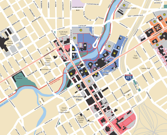
I found these “Flint by Foot” maps by The Greenway Collaborative to be interesting as a point in time image of what Downtown looked like and how opportunities were presented before the Great Recession and before the Flint Water Crisis. Walking across Downtown from Kettering to Mott Park past UM Flint campus was estimated to take 45 minutes.
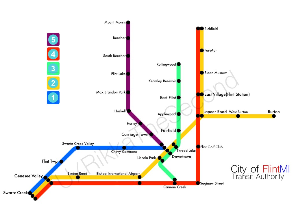
What if “Vehicle City” had a metro rail system? This is a long running topic for the Detroit metro area where I organize an annual “transit fantasy” meetup where people have created over a dozen fake mass transit systems over the years.
This transit fantasy map of Flint comes from Redditor, RikkaTheSecond:
I was bored and decided to make a Metro Map! I randomised all the cities in the US to decide what to do and it came up with the quaint town of Flint, Michigan, north of Detroit. This was probably the most design-focused map I’ve done in a while, as halfway through making it I really started loathing the design. I did my best to try and make it look good and overall I think I did a good job. Let me know what you think of it!



 Mapping Flint